MMIS Concepts and Technologies
MMIS is the new format/face of MIS-"M" is the value-added Map that ensures Cost and Time Optimizations for client Organizations by meeting the green obligation automatically, when MMIS concepts-based products are deployed.
Map Management Information Systems are all about…
…Connecting Knowledge to your very existing information systems/forces directly,by navigating information forces to its location or destination. This enables us to conclude ILC(Information Life Cycle)in a knowledgeable form for effective results through optimization of the Organization's scarce and precious resources. This results in an effective logical administrative mechanism with respect to the goals & objectives of various projects and programs, that Government Departments undertake from time to time towards Infrastructure development or any other Services by Geo auto auditing mechanisms of the Information Forces in an intelligent form and hence format a new dimension in knowledge solutions altogether.
Background:
Government resources are becoming increasingly precious and scarce day by day, throwing challenges to the Bureaucrats, Technocrats and to the technologies that handle these very precious scarce resources in the most optimal manner collectively in driving the programs and projects from time to time. In this context we would observe that around 27 departments of various ministries render services to the citizens who are location-based belonging to the farming and non-farming communities.
Various departments have to exchange information amongst themselves individually and collectively like the Ministry of Information Technology,the Ministry of Science & technology, the Ministry of Agriculture etc., and interestingly we all operate in the very same geography that includes Corporate Sector, Banks, Insurance Companies, Health and Safety departments. We would observe and note that Geography is a common and understandable source for everyone.
Today, we are influenced and governed by IT systems. These IT & ICT systems play a pivotal role in achieving optimal benefits on the Resource utilization/Consumption front, in deriving the intended economic goals and objectives of the organization in the most efficient and effective form with the aid of IT systems from time to time. These IT systems have helped us in having an accurate & consistent flow of information for decision-makers in the given framework.
This information flow has resulted in an Information overflow leaving Government officials and Strategic managers on their toes in compiling the requisite knowledge amongst various Information forces.In this context there is a need to audit our own information forces that communicate operations of the organization in various geographical locations in an intelligent form which enable every strategic manager to publish and submit the knowledge in an understandable format for everyone involved in the decision process of the organization.
MMIS concepts are aimed towards publishing the knowledge through Open Knowledge Source (OKS),a soft tool that could be a source and resource useful from the planning stage to the implementation stage of various projects and programs of any Government Department through Base Knowledge Tool(BKT) mechanisms identified under the MMIS concept. This would help Finance, HR, Planning and other important department of the Ministries. These BKT mechanisms enable one to view the MIS forces in an intelligent and acceptable knowledge form. This is done by capping/jelling with the departments MIS situation and setup with a few addons.
Scope and the basis of MMIS:
In the light of the discussed context we may conclude that:
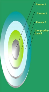
- All the government departments of the ministry are geographically located
- Departments operations are geography-based
- Administration is geographical in nature:
- Selling or rendering service is in this very geography
- Other dependent information sources and resources like demographics etc are geographical in nature.
- Thus all our transactions are of geographical relevance
- MIS(Management information Systems)that communicates our actions are geographic
- Thus all our MIS forces are geographic-based
- Geography is also true for corporate, banks,insurance companies for their economics.
Thus,geography is the source and resource for everyone of us.
MMIS concepts re-orient the MIS(by preserving existing MIS setups)of the organization in a geographical context through geomap/MIS audit and Intelligent communication by mapping actual knowledge needs through a holistic approach that is fit and apt for the Organizations under the frozen MIS situations and system studies. This enables and ensures to position your organization with respect to others under OKS mechanisms that map your vision and mission of the Organization through knowledge integrations and harmony by helping to view your operations and its administration in a more realistic form, making you more tuned to a Global Competitive Economy where uncertainty is only the certainty.
We re-orient your information forces in an equated mode(patented)which enables you to bring your yesterdays MIS into this format and get on with the current ones and of tomorrow MIS forces.
Advantages of MMIS
Every Strategic Manager’s tool from Operations to the Corporate sector:- Optimizing ERP effectiveness–that communicates Knowledge needs that helps him to take almost Online Decisions.
- Can track and map his goals and objectives in a programmable manner.
- Organizational Resources are effectively managed.
- The connectivity amongst various departments of the ministry and across ministries can be easily connected from the knowledge perspective, for an effective planning and realisation of the Individual and Collective goals under the theme Mapping hours of the concepts.